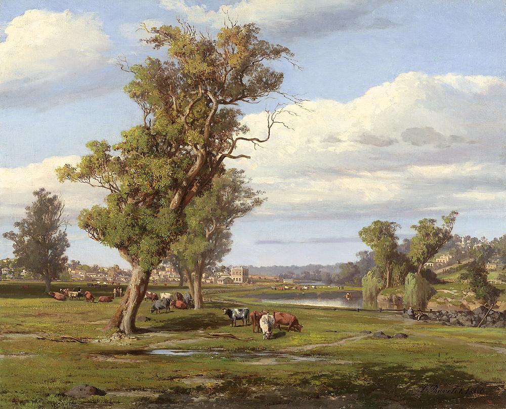
The flats of what we now call Cremorne is the result of volcanic flows that made their way around Richmond Hill to meet the higher ground of South Yarra. Creeks and rivers converging from the north and east, forming the Yarra River, followed the boundary of the new volcanic rock and the older, softer sedimentary.
This is the country of the Wurundjeri, a Woi Wurrung speaking people of the Kulin Nation. They knew the river as Birrarung – the ‘river of mists and shadows’. The landscape of these river flats was an open grassy woodland of river red gums including a diversity of grassland flora that the Wurundjeri nurtured as food plants.
The first Europeans to encounter this country found a meandering river fringed with billabongs and wetlands. A billabong in Cremorne became known as Wright’s Swamp. The meandering river was very dynamic without well-defined banks. It ebbed and flowed, changing its size and shape regularly. Floods were a frequent event well into the twentieth century. The banks were thick with tea tree and wattle while the river itself contained a tangle of fallen timber and vegetation. This debris was important in providing refuge for life in the river and contributed a clear and healthy waterway. The billabongs and wetlands of the river made it extraordinarily rich in wildlife and important as a food resource for the local Wurundjeri.
Billabongs and swamps were sprinkled right around the bay, and they teemed with brolgas, magpie geese, Cape Barren geese, swans, ducks, eels and frogs. So abundant was the wildlife that you can imagine the Melbourne area as a sort of temperate Kakadu…
Tim Flannery ‘The Birth of Melbourne’ 2002
Governor Richard Bourke, 1837. As quoted by Kristin Otto, ‘Yarra’ 2005
The Yarra continues a fine full stream of clear water in places bubbling over ledges of rock, at others forming fine deep reaches… It is perhaps the finest river I have seen in New South Wales… The Yarra abounds in fine fish and the water is of very good quality.
The development of Melbourne from 1835 led to a sudden influx of cattle and sheep to support the new colony, taking advantage of the open park-like country that the Wurundjeri nurtured through their traditional practices such as burning. The landscape soon lost its picturesque quality as trees were cleared and livestock consumed and degraded the grassland. The dispossessed Wurundjeri consequently lost their capacity for the traditional lifestyle that sustained them.
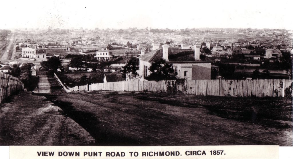
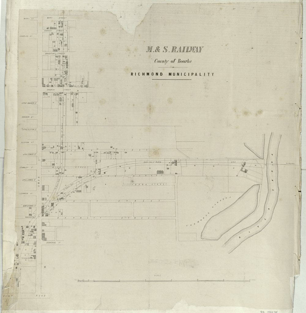
The Cremorne area was split into long north-south allotments and sold in 1846 and 1849, generally reflecting the existing street arrangement. Initially sold as agricultural lots, the land north of Balmain St became primarily residential, with schools, churches, shops and hotels while the south side attracted industry such as breweries and tanneries by the river.
A significant inclusion to the space between Balmain Street and then river was the Cremorne Gardens. Operating between 1853 and 1863, It was a ‘pleasure garden’ modelled on the Cremorne Gardens in London. During those gold rush years was quite a draw card for people looking for entertainment. Apart from the ornamental gardens, it included bars, dance pavilions, menageries and attractions that included fireworks and hot air balloon launches. The railway to Brighton bisected Cremorne in 1857 and briefly included a Cremorne station at Balmain St to service the Gardens. The railway to Hawthorn in 1860 has since contributed to Cremorne as an enclave, developing its own distinctive identity.